Wind, Waves, and New Pages- Part 4 of 7

The pilot boat leading the way into the port of Funchal on the island of Madeira.
The trip from La Palma wasn’t anybody’s idea of champaign sailing. 12-15 foot seas and 40 knot winds kept us rocking and rolling all night. Because of the distance between islands and the need to slow down, the ship arrived just after noon. Turns out, the extra sack time was a blessing for many of our fellow travelers who recovering from the sleepless and seasick night. The Captain and I didn’t suffer much, thanks to some time tested strategies for coping with the ol’ mal de mer.
The port call was scheduled to be thirty-six hours, much longer than the usual day trip, so we had time for several activities on Madeira. In the wake of the passing weather system, there were summer-like warm temperatures and sunny skies. Perfect for wandering into the old Portuguese city of Funchal on foot.

We felt right at home when we walked past Funchal’s boat park and saw J24s, ILCA dinghies, 420s, Opties and an assortment of other sailboats and sailboards. Later in the day, a dozen boats were out for sailing class at the mouth of the harbor.
The island is about 32 by 12 miles with interior mountains of volcanic origin reaching 3,000 feet above sea level. The population is currently 250,000, with most of them living in Funchal or its surrounding towns. Agriculture is the largest industry, growing lots of bananas and some other fruits. Sweet potatoes, sugar cane, and vineyards for local Madeira wine, also make up a measurable portion of the economy. Tourism is also coming on strong, right behind the monetary contribution of iconic footballer and native son Cristiano Ronaldo dos Santos Aveiro, aka “Ronaldo.”
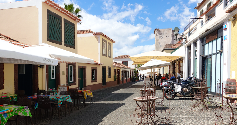
The streets of Funchal are as welcoming as any in Europe.
The island and its smaller neighbor Porto Santo were discovered by Portuguese navigators in 1419 when they were blown off course while exploring the west coast of Africa. The islands were settled soon after and exploited for their stands of tall timber. The Spanish temporarily occupied the island from 1580 until 1640, and it was after this time the islands fortifications were built to protect commerce. Madeira wine soon came on the scene as a favorite banquet beverage in American, Britain and Russia during the 18th and 19th centuries.

Fortifications dating to the 1600s still guard the entrance to the harbor.
After spending a delightful afternoon wandering the town, we returned to the ship to join our next adventure, an off-road tour in the mountains. Our little group was loaded into the back of top-down Defender 110 trucks and we rolled out in fine style. The trucks climbed up and up, above the lower semi-tropical level and into the middle level of flora. Like most of the Canary islands, this altitude range of the Madeira mountains is overgrown with invasive eucalyptus trees, and the government is engaged in a battle to control their spread. For off-road enthusiasts, the rough cut roads through the eucalyptus groves make great driving that also smells nice.

These old Defender 110s are well suited to the steep, narrow, and often flooded backroads.

After bouncing along the muddy tracks, the drivers began the slightly terrifying descent towards the ocean and the sunset point on the island’s southwest beach.

The last of the sunlight was appreciated from the stone beach at Ponta do Sol while the local barkeep passed around cups of poncha, the local rum and fruit juice beverage.

The last stop on the off-road journey was an overlook where we caught the moonrise over Funchal.
The next day’s activity began right after breakfast and we were correctly advised it would muddy and wet. Our guide gathered the adventurous souls from the pier and trucked us back into the hills for a hike along the Levada aqueducts. As sporty as the ride was the previous evening, walking along the edge of a slippery, muddy mountain path was a higher level of fun.

The beginning of our hike. Try not to think about how much it will hurt to fall down the hill.
The Levada system has been around for hundreds of years. Concrete channels follow the topographical contour lines on the sides of the rainy northwest mountains with a one to two percent grade towards the southeast. The water is directed into terraced farms on the south slopes of the mountains. It is estimated there are 2,100 kilometers of channels and associated service paths on the island.

The levada channel follows a gentle slope, winding along the mountain side. The paths are very popular for hiking.

The rural farms are built on terraces. Gates in the concrete channel can direct water to the various levels below. At the end of the channels, the unused water is directed into hydro-electric stations and then collected at water treatment plants.

A terrace below the levada channel planted with taro. We covered several miles on the Levada del Norte, except for the mist, drizzle, and mud, it was pleasant hiking with beautiful scenery.

The itinerary called for a day at sea en route to the next stop in Morocco. We were ready for a day of rest.