Vacation Part 5- The Dardanelles

During our first overnight transit, the cruise ship crossed the Sea of Marmara and proceeded down the narrow slot between Europe and Asia to dock at Canakkale, a small city on the Asia side of the narrowest point in the waterway. The port serves the local agriculture and wine production. It is also the place to go for visiting the ancient city of Troy and the World War One battlefield at Gallipoli.
I first learned about the Dardanelles in middle school from a book called The Lion at Sea. The story included a fictionalized account of a Royan Navy submarine sneaking through the mile wide channelduring the World War One Allied campaign against the Ottoman Turks. (An Australian sub was the author’s inspiration.) Then I saw the 1981 the movie “Gallipoli” staring a very young Mel Gibson. Ever since then, I’ve been intrigued by accounts of the region. So, for our first morning on the ship, I was thrilled to be looking at the actual Dardanelles.

The area has been a geo-political flash point since the Ancient Greeks established a trade route into the Black Sea and, as expected, it is appropriately fortified.
The day’s adventure was a tour of the Gallipoli battlefield and it started with a delay at the ferry terminal. There wasn’t room for the tour bus on the boat, so we had to wait for next one. In the mean time we walked down the waterfront to the display of the giant “wooden horse” donated to the town after the 2004 Hollywood production of “Troy.” Well, that was something, and it killed half an hour.

The fiberglass “wooden horse.”

Crossing to the Gallipoli Peninsula requires dodging commercial shipping.
Quick history of the Allied attempt to knock the Ottomans out of World War One: In the spring of 1915, the British and her Allies were looking for a way to hasten the end of the stagnated eight month land war in Europe. The First Lord of the Admiralty, a fellow named Winston Churchill, proposed knocking the Ottomans out of the war by taking Constantinople and opening a supply route to the Russian allies via the warm water port of Sevastopol.
After a failed attempt to force their way through with battleships on March 18, the Allied plan was to land troops on the Gallipoli Peninsula to defeat the northern fortifications guarding the waterway, an operation that was expected ed to take a few days. On April 25, troops were rowed ashore on lighters and ships boats. They met some light resistance, but because of the usual fog of war, they failed to exploit any advantages and the offensive operations ground to a halt in favor of consolidating gains. Counter-attacks by the Ottomans followed on April 27, and it didn’t take long for the entire operation to become a hopeless battle of attrition. Offensives and counter-offensives followed, resulting in massive casualties on both sides. Finally, the Allied troops were evacuated in the closing months of 1915. It is estimated that in eight months, the Allies suffered 56,000 Dead, 123,000 wounded, and 7,000 missing. Another 165,000 were evacuated for illnesses such as typhoid and dysentery. The Ottomans lost approximately 56,000 dead, 97,000 wounded, and 11,000 missing. They evacuated 64,000 for illness.
A noteworthy aspect of the allied operation was the use of 50,000 Austrailian and 16,000 New Zealand troops. The Aussies lost 8,700 and the Kiwis 2,700 dead, making a profound impact on those sparsely populated countries. April 25 became the day for recognizing the loss and sacrifice. (In 1914, Australia had a population of 4.9 million and New Zealand was just over 1 million.) It is marked as a holiday in Australia and New Zealand, as well as other parts of the Pacific.
For comparison purposes, in Viet Nam, the US lost 40,934 to combat action, 9,107 to accidents, and 8,179 to all other causes between 1954 and 1975.
Our tour started at the official Simulation Center Museum. It is a group of four panoramic theaters that depicted the major events, personalities and heros of the campaign to defeat the allies invading the Ottoman Empire. The central figures include the “arrogant” Winston Churchill and Lord Kitchner versus the brilliant and virtuous Mustafa Kemal Ataturk. In case you are wondering, yes, that is how they were depicted. And yes, it makes you take a second look at everything you know about the presentation of heros in your own homeland.
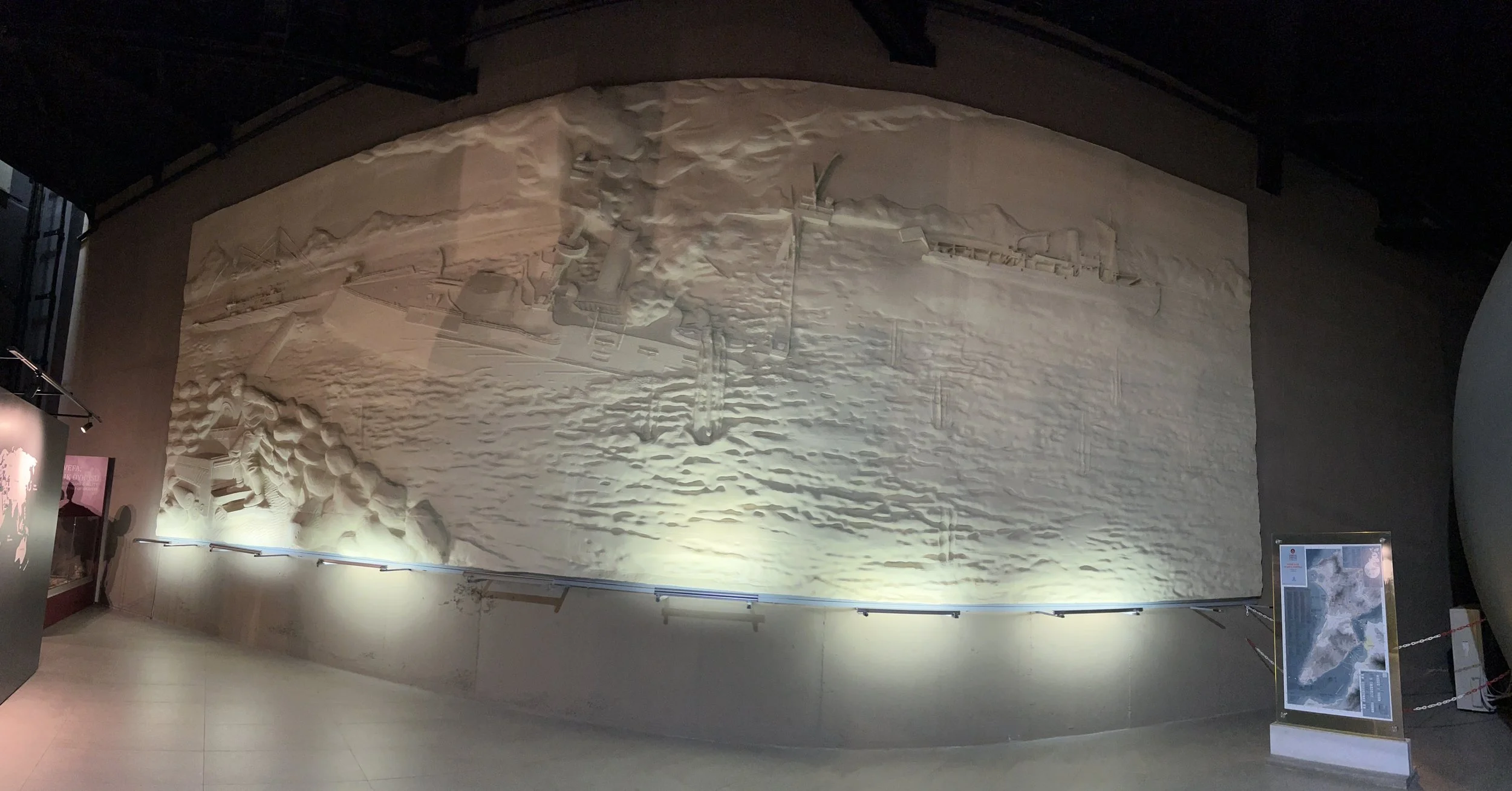
An artistic depiction of the heroic Ottoman coast artillery and minlayer destorying a British warship.
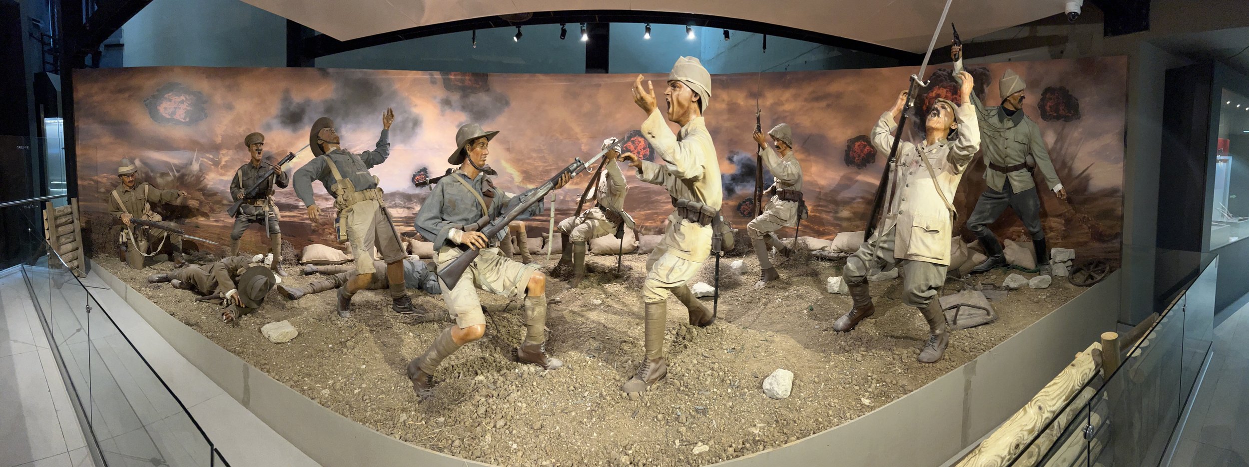
Life size dioramas celebrate the Turkish troops martyred in defense of the Ottoman Empire.
With the basic understanding of the timeline and how the Turks feel about the fight, we rode out to the invasion beaches with our tour bus full of Aussies, Kiwis, Canucks and Brits. Unfortunately, photos don’t really reveal the compactness of the battle space and it is almost impossible to image thousands of troops seeking cover from enemy fire.


The marker denotes the south end of the primary invasion beaches.

The 600 meter concave beach in ANZAC Cove. Marginally protected from the Ottoman crossfire, it became very crowded during the course of the campaign. The thousands of troops in the pre-dawn darkness of the initial landing were expecting a wide beach and flat terrain. The road didn’t exist in 1915 and the ground had very few trees, but the hills were just as tall.

Looking north from the ANZAC Memorial along the North Beach.
Looking up from the North Beach at the Ottoman defended south promontory called Plugge’s Plateau.

Looking up at the Ottoman defended hill know as the Sphinx from the North Beach.

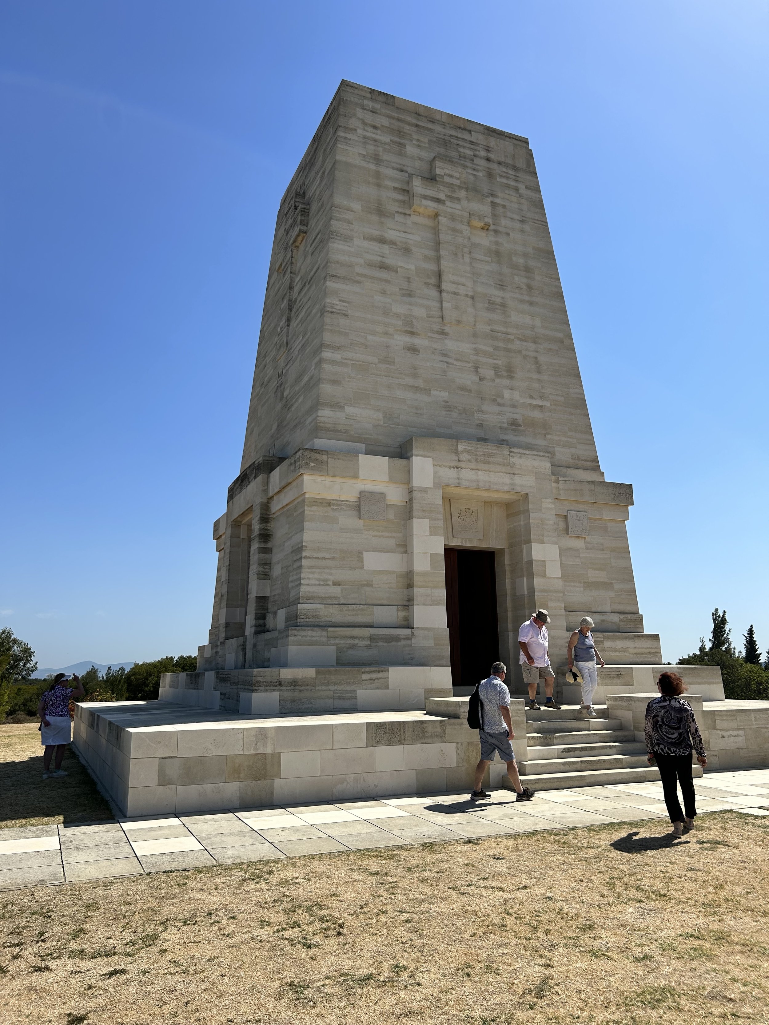
The ANZAC Memorial hosts a sunrise service on April 25 each year to remember the fallen Allies and Turks.
The dive boat is anchored over a ship scuttled during the campaign to form a breakwater.
For the Allies, the fighting was mostly uphill, trying to occupy the ridge line that separated them from the open land that descended to the fortifications on the south shore of the peninsula. Departing the beach, the bus took us up to the top of the ridge line where there are countless mass graves and memorials.

The Memorial for ANZAC troops who fell at the Battle of Lone Pine between August 6 and 10 of 1915.
Markers and memorials were placed in the vicinity of where the troops fell. The exact disposition of the remains in unknown.
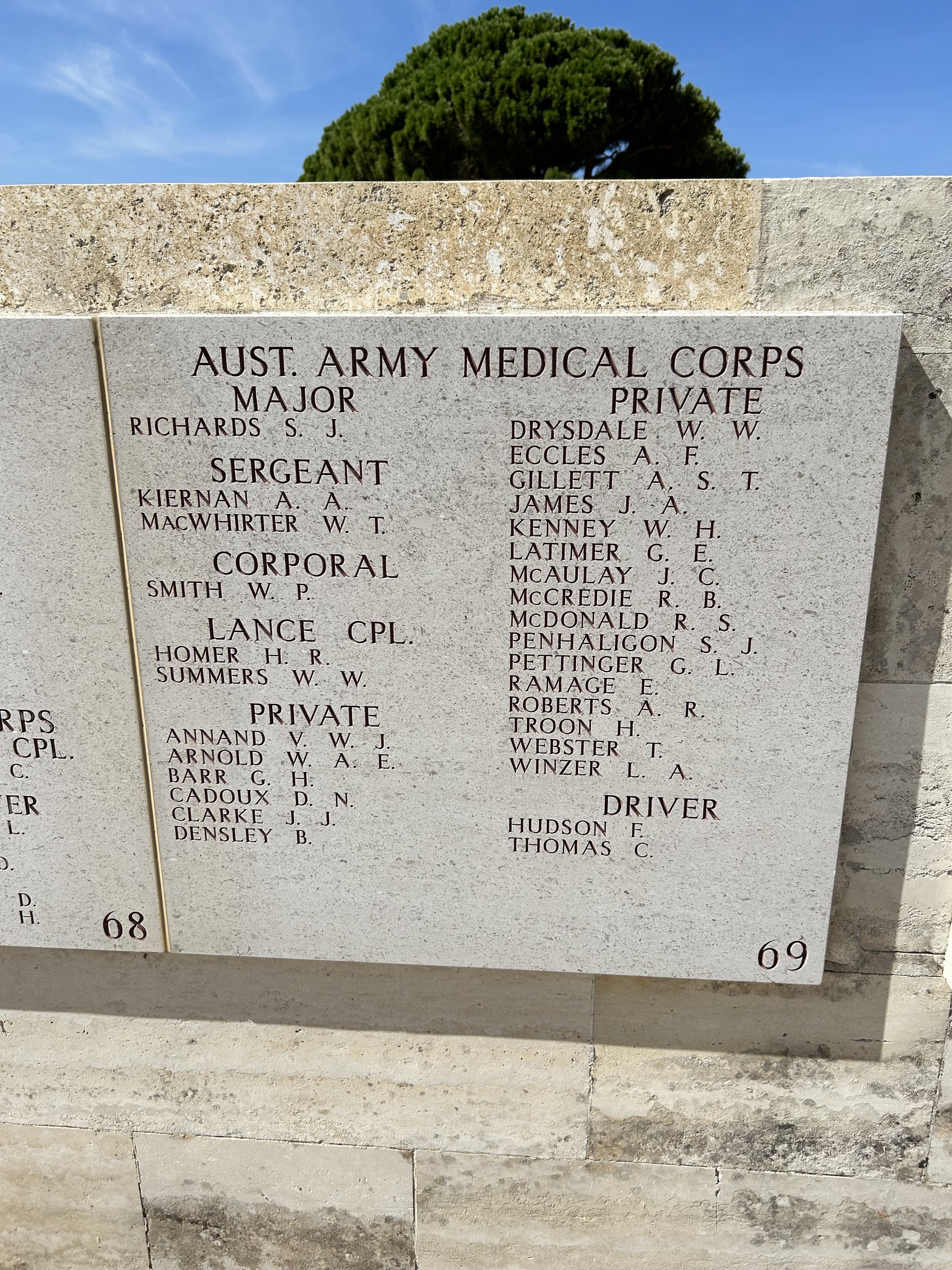
A panel of the memorial wall.

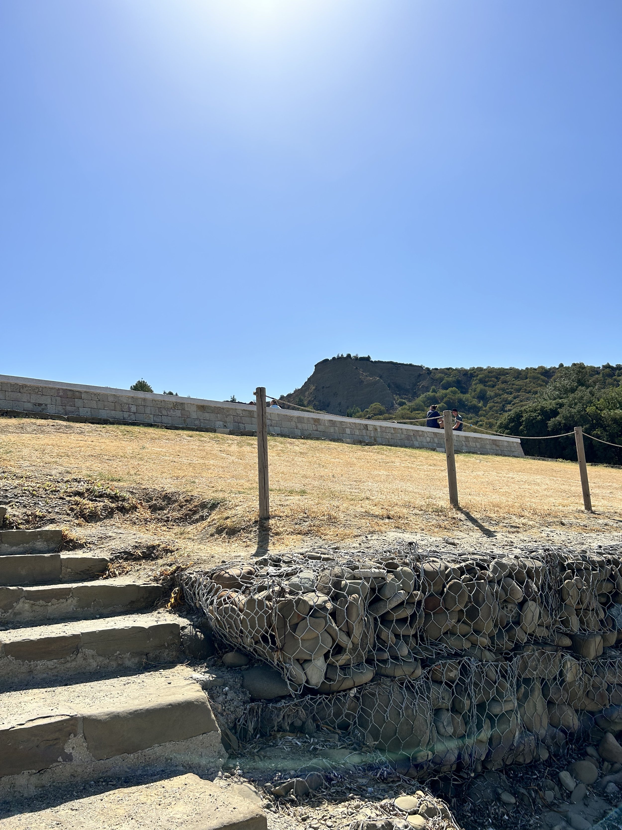
The Turkish Alay Memorial and Cemetery.

The Alay Memorial is built on the highest terrain the Allies managed to occupy. Until they were pushed back, the troops could see the objective to the southeast.
After cresting the hill and seeing the scope of the battle, we came to understand the compactness of the space. It is hard to image the numbers of troops and materiel involved for the eight months of the campaign. Most of the fellow travelers on our tour were speechless by this time, and rode back to the ship lost in their own thoughts about the place.
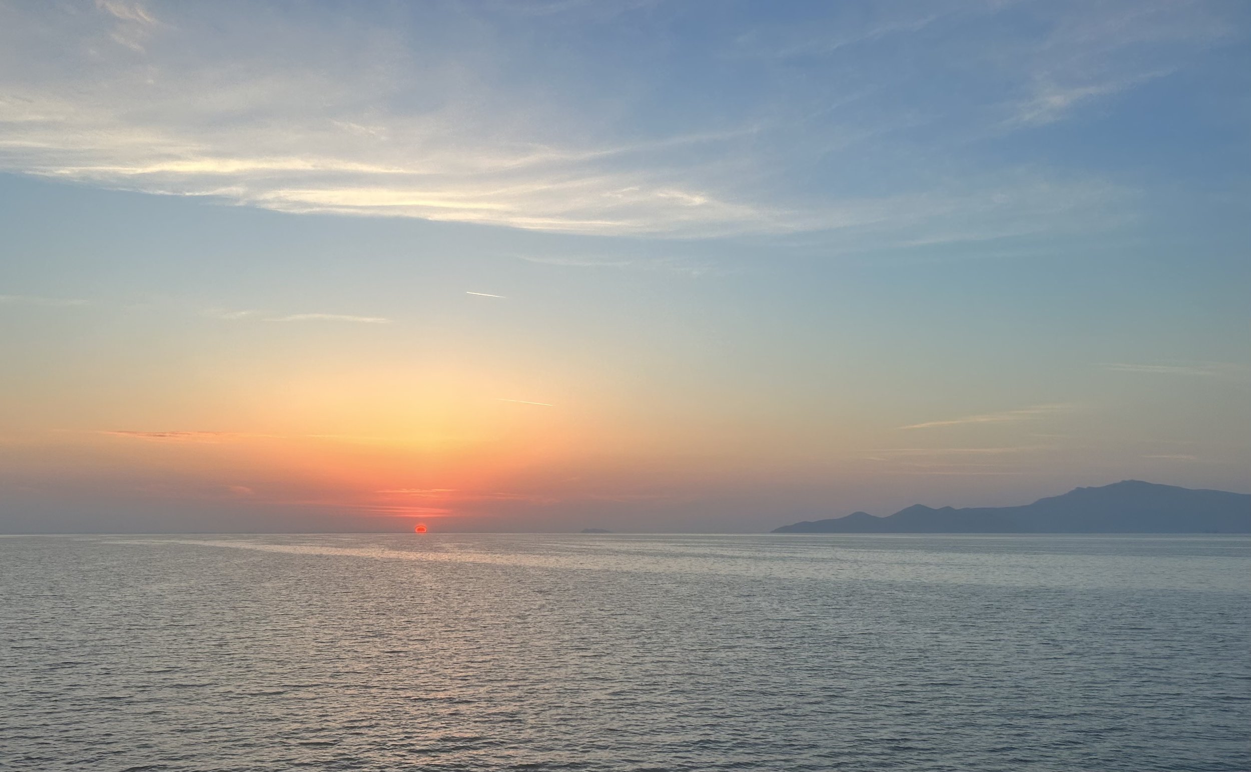
The day ended with the ship heading out of Turkish waters at sunset. The next day we’d be in the Greek port of Kavala.